Sunday, February 12, 2023
Stormy (Maybe Snowy?) Start to Valentine's Day
Posted By Kimberly Wear @kimberly_wear on Sun, Feb 12, 2023 at 12:44 PM

Don’t be fooled by today’s sunny skies and calm demeanor — some wild weather is on its way.
A dry cold front headed this way is forecast to bring gusty winds and a wind advisory is in effect from 1 p.m. Monday to 4 a.m. Tuesday, with 20 to 25 mph winds expected and gusts up to 50 mph, especially along exposed ridges and coastal headlands.
“Gusty winds could blow around unsecured objects,” the National Weather Service’s Eureka office states in the advisory. “Tree limbs could be blown down and a few power outages may result."
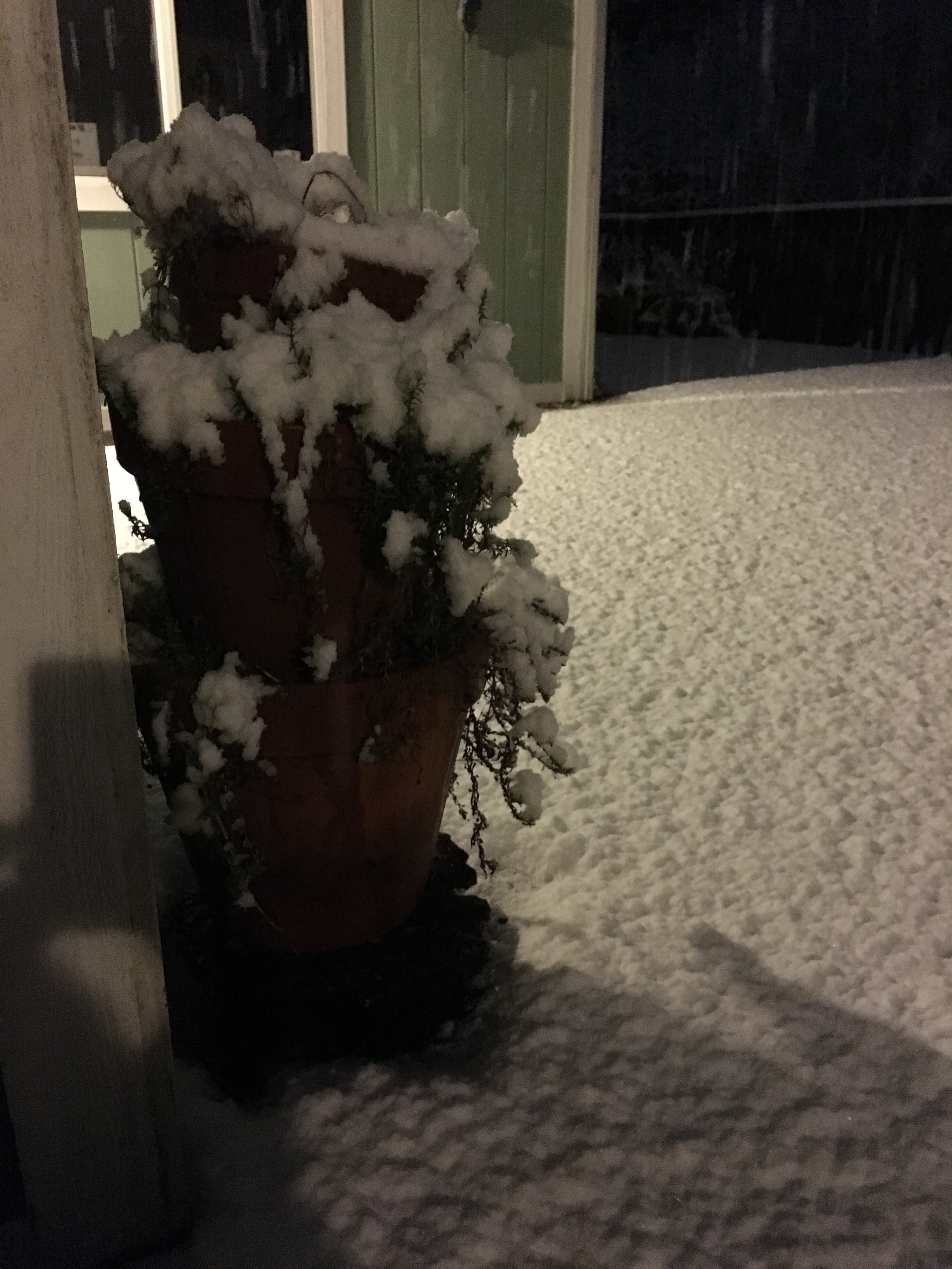
That front — with “very cold” air behind it — will set the stage for the possibility of snow as low as 1,000 feet Tuesday morning.
“Albeit light, this is almost certain (to be) the lowest snow of the season so far,” the NWS states.
Four years ago, on Feb. 9 and Feb. 10, even the coast received quite the dusting, with accumulations of around an inch — and up to 4 — in areas from Eureka to the Arcata Bottoms and up to McKinleyville and Westhaven.
Earlier forecasts had the possibility of snow down sea level, so we’ll see. A winter weather advisory is in effect from 1 a.m. to 2 p.m. Tuesday above 1,000 feet.
“Travel could be very difficult to impossible,” the advisory states. “The hazardous conditions could impact the morning commute. Gusty winds could bring down tree branches.”
Snowfall possibilities issued by NWS as of 6 a.m. today gives the chance of even light flurries Tuesday morning producing around a tenth of an inch at 21 percent on the coast, moving up to a 75 percent chance in Hoopa and a 99 percent chance at Berry Summitt — which also has a 50 percent chance of 4 or more inches.
As the morning moves on Tuesday, showers are likely on the coast, with thunderstorms and hail a possibility after 11 a.m. For inland areas like Hoopa, rain/snow showers are slated to give way to a partly sunny day, with winds of 11 to 16 mph and gusts up to 26 mph.
A dry cold front headed this way is forecast to bring gusty winds and a wind advisory is in effect from 1 p.m. Monday to 4 a.m. Tuesday, with 20 to 25 mph winds expected and gusts up to 50 mph, especially along exposed ridges and coastal headlands.
“Gusty winds could blow around unsecured objects,” the National Weather Service’s Eureka office states in the advisory. “Tree limbs could be blown down and a few power outages may result."
That front — with “very cold” air behind it — will set the stage for the possibility of snow as low as 1,000 feet Tuesday morning.
“Albeit light, this is almost certain (to be) the lowest snow of the season so far,” the NWS states.
Four years ago, on Feb. 9 and Feb. 10, even the coast received quite the dusting, with accumulations of around an inch — and up to 4 — in areas from Eureka to the Arcata Bottoms and up to McKinleyville and Westhaven.
Earlier forecasts had the possibility of snow down sea level, so we’ll see. A winter weather advisory is in effect from 1 a.m. to 2 p.m. Tuesday above 1,000 feet.
“Travel could be very difficult to impossible,” the advisory states. “The hazardous conditions could impact the morning commute. Gusty winds could bring down tree branches.”
Snowfall possibilities issued by NWS as of 6 a.m. today gives the chance of even light flurries Tuesday morning producing around a tenth of an inch at 21 percent on the coast, moving up to a 75 percent chance in Hoopa and a 99 percent chance at Berry Summitt — which also has a 50 percent chance of 4 or more inches.
As the morning moves on Tuesday, showers are likely on the coast, with thunderstorms and hail a possibility after 11 a.m. For inland areas like Hoopa, rain/snow showers are slated to give way to a partly sunny day, with winds of 11 to 16 mph and gusts up to 26 mph.
Speaking of...


Readers also liked…
About The Author
Kimberly Wear
Bio:
Kimberly Wear is the assistant editor of the North Coast Journal.
Kimberly Wear is the assistant editor of the North Coast Journal.
more from the author
-
Huffman Joins Colleagues in Calling for Biden to ‘Pass the Torch’
- Jul 19, 2024
-
SECOND UPDATE: Victim of Fatal Shooting Identified
- Jul 17, 2024
-
Eureka Man Killed in SoHum Crash
- Jul 1, 2024
- More »


